Heritage Walks are FREE, guided interpretive walks to the most interesting historic, cultural, industrial, natural and scenic sites in Berkshire County, MA, & Litchfield County, CT.
2024 – THE 22nd ANNUAL “HOUSATONIC HERITAGE WALKS”
Saturdays & Sundays on…Sept. 7 & 8, 14 & 15, 21 & 22, 28 & 29, Oct. 5 & 6
*** Download the 2024 Heritage Walks Brochure here!***
We’re extremely grateful for our ‘HERITAGE WALKS’ sponsors!

SATURDAY – SEPT 7, 2024
PLEASE NOTE–FOR ALL HIKES/OUTDOOR WALKS, PLEASE WEAR HIKING BOOTS/STURDY FOOTWEAR, SUGGEST BRINGING DRINK & SNACK, BUG REPELLENT AND BE PREPARED FOR INCLEMENT WEATHER
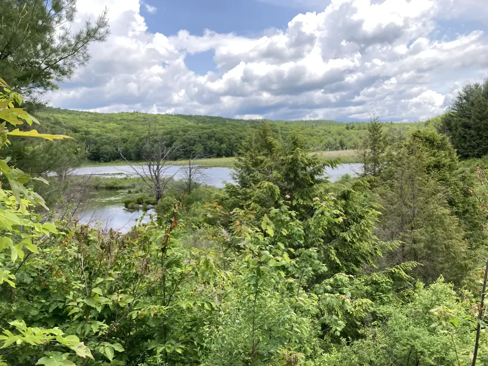
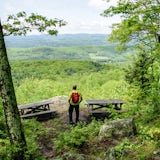
1 – New Marlborough/Monterey, MA 9 AM – 12 NOON
A WOODLAND HIKE FROM GOULD FARM TO THE BERKSHIRE NATIONAL FISH HATCHERY
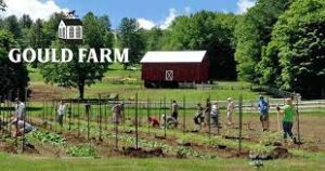
Gould Farm is a therapeutic community that promotes recovery for people with mental health and related challenges through meaningful work, community living, and clinical care. The hike begins at Gould Farm’s Harvest Barn Bakery, and you’ll learn about the Farm’s history, mission, and connection to the land as you walk along the forested trails with Liz Halla-Mattingly and Amy Dillingham.
The second half of the walk will be led by Joseph Xamountry and David Ziegler from the Berkshire National Fish Hatchery , who will take you on a tour of the historic property, where, for over a century, hundreds of thousands of fish have been cultured in a pristine aquifer that supplies a system of beautiful, natural pools with 200 gallons of water per minute. Refreshments will be served at the fish hatchery followed by van service back to Gould Farm. Rain or shine. 3 hours – 3 miles
Meet at Gould Farm, 54 Gould Road. From Rt 102 in Lee, at the traffic light at Big Y–take Tyringham Rd and drive 5.5 miles south, then turn right on to Monterey Rd and drive 4 miles to Rt 23 in Monterey center. At Rt 23, turn right, and drive 2 miles, then turn left onto Curtis Rd and drive 0.5 mile to Gould Rd. Turn left and continue to the 2nd driveway, to the Harvest Barn OR From the traffic light junction of Rts 7 & 23 in Gt. Barrington–Take Rt 23 east and drive 6.2 miles and turn right onto Curtis Rd and drive 0.5 mile to Gould Rd, then turn left and continue to the 2nd driveway, to the Harvest Barn. GPS 42.17477, -73.24111 GOOGLE MAP
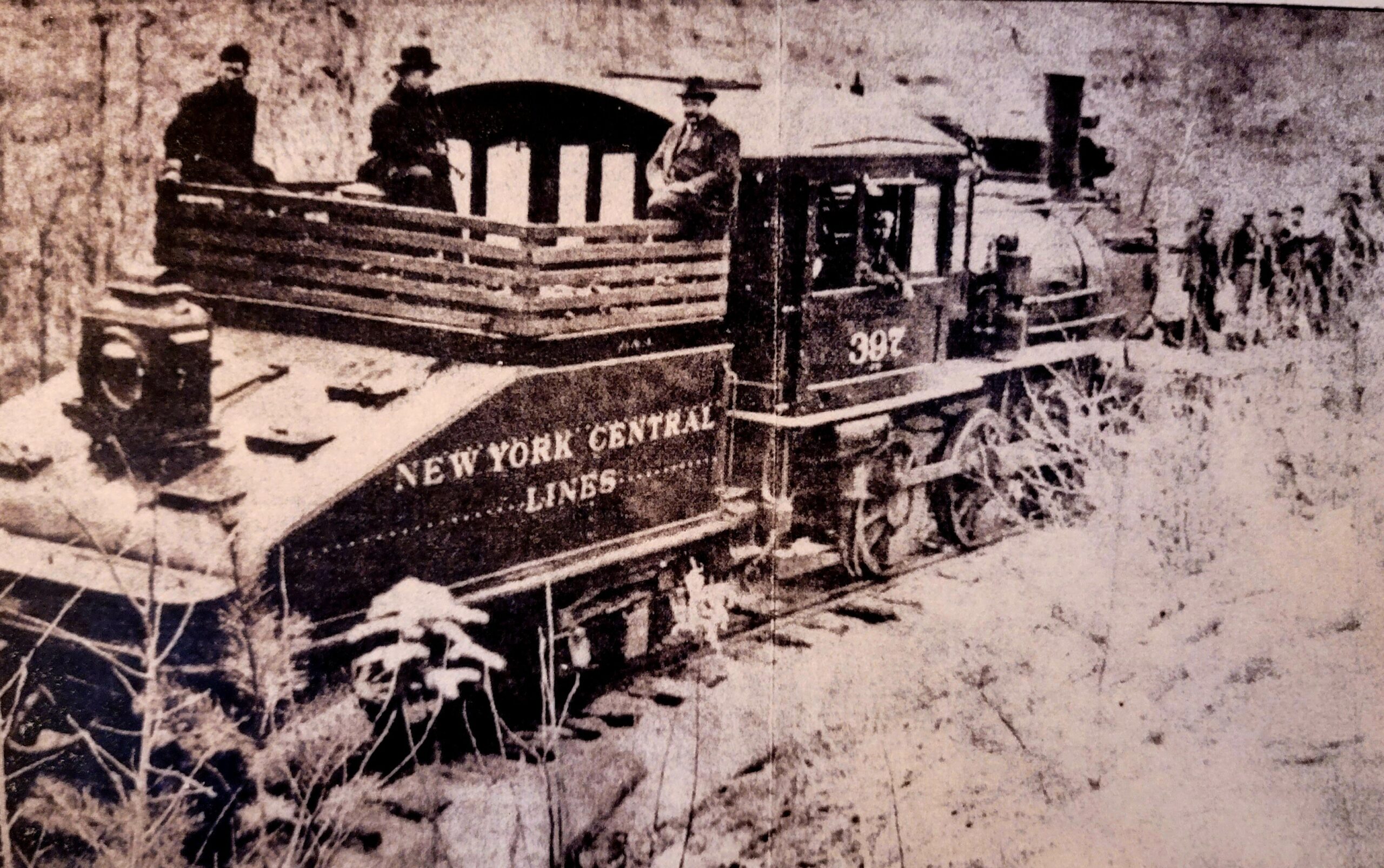
2 – Becket, MA 9:30 AM – 1 PM
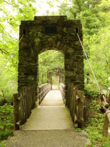
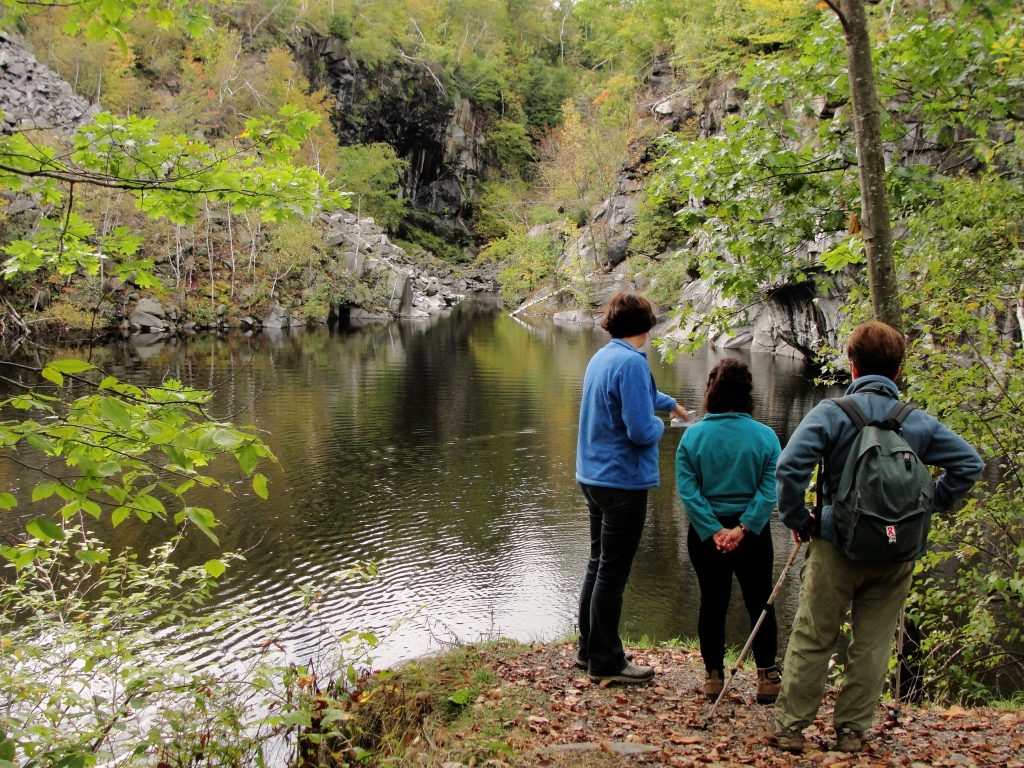
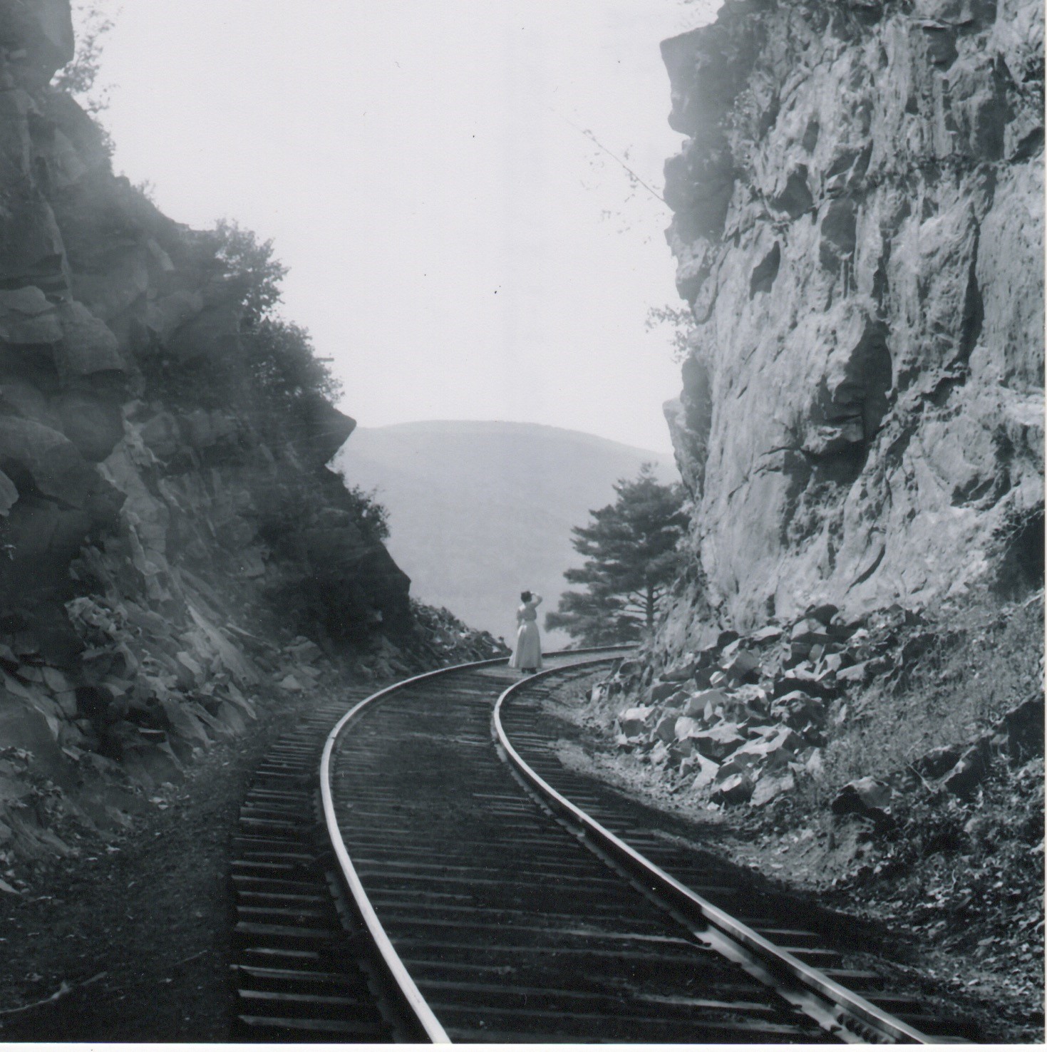
HISTORY HIKE TO THE KEYSTONE ARCHES BRIDGES–A MOST MAGNIFICENT ENGINEERING FEAT BUILT IN THE 1840’s !
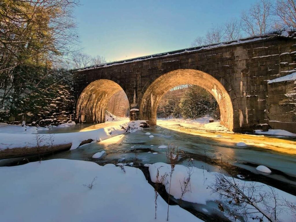
Join Dave Pierce, from the Friends of the Keystone Arches , for a hike to the first cluster of stone arch railway bridges built in America, in the 1840’s. They are impressive, breath-taking stone structures, up to 70 feet high, brilliantly revealing their ancestry in the great cathedrals of ancient Rome! NOTE–An inside tour of the Chester Railway Station Museum can be arranged after the free Heritage Walk. Donations are accepted. The Arches and the Railway Station were designated as National Historic Landmarks in 2021. 3.5 hours – 5 miles
To register, email – dpiercedlp@aol.com or 413-961-9166
From junction of Rts 20 & 102 in Lee, take Rt 20 east and drive 18 miles to Chester center. Meet at the Chester Railway Museum, 10 Prospect St. We will carpool 2 miles to the trailhead. GPS 42.28054, -72.97860 GOOGLE MAP
3 – Pittsfield, MA 10 AM – 12 NOON
BEGINNER NATURALIST WALK AT WILD ACRES
Join Chelsey Simmons, of Berkshire Environmental Action Team (BEAT) for this easy, leisurely walk in Wild Acres Park, a Pittsfield Conservation Area that contains an expansive wetland and forested walking trails. Participants will observe some of the wonderful things found in nature during late summer in the Berkshires and learn about the area’s plants, animals, fungi, and natural history. Limited to 10 participants. 2 hours – 1.5 miles
Registration is required. Email – chelsey@thebeatnews.org
Wild Acres is located off South Mountain Road in Pittsfield, a connector road between Barker Rd./ Swamp Rd. and Rt 7/20 (South St.). Visitors will find a large parking lot at the end of a long driveway off of South Mountain Road (at the bend in the road). If the main gate is closed, an additional parking lot is located halfway down the driveway. GPS 42.429035, -73.281083
4 – Sharon, CT 10 AM – 12 NOON
GOODBODY PRESERVE–HIKE INDIAN MOUNTAIN
Join Tim Hunter and the Sharon Land Trust for this hike on this 188-acre preserve, which offers spectacular views of the Sharon Valley and Indian Lake. Take a deep breath and enjoy the view, as the lands that are seen from this lookout are almost all preserved, either by the Sharon Land Trust or by other regional conservation organizations. Parts of this hike are steep, as the trail gains elevation of 1,065 feet. For intermediate to advanced hikers. 2 hours–2.5 miles
To register – timhunter@sharonlandtrust.org OR (860) 364-5137
Meet at the trailhead, at 140 Millerton Road (Rt 361), Sharon, CT (0.6 mile south of Dakin Road). Parking is at the top of a short, but steep, drive up to a farm field parking area GPS 41.904849, -73.491425
5 – Salisbury, CT 10 AM – 11 AM
AN INTERPRETIVE WALK THROUGH THE DARK HOLLOW PRESERVE
Join Tom Key, from the Salisbury Association Land Trust, for a walk on the three major trails in the Dark Hollow Preserve. The trails run through mixed hardwoods and pine/hemlock forest, skirt large rock outcroppings, and descend along fields and wetlands. Prominent along one of the trails is a demonstration of the power of nature from a micro burst of wind 4 years ago. Old maps of the area have Farnam Road named Spooky Lane and Dark Hollow designated as Spooky Hollow. We will discuss the possible reasons for these names but hopefully will not encounter the rationale/remnants for the designations. Actually they are quite shy, but do not whistle during the walk! 1 hour–2.5 miles
If coming from Farnam Rd. (South end), meet at the first pull off on Dark Hollow Rd. OR if coming from Salmon Kill Road, go to the last pull off. To view and download trail maps, visit https://salisburyassociation.org/land-trust/hiking-trails-preserves/ GPS 41.964148, -73.417601
6 – East Canaan, CT 10 AM – 2 PM
1-HOUR TOURS OF THE BECKLEY BLAST FURNACE, CT’S DEDICATED IRON INDUSTRIAL MONUMENT
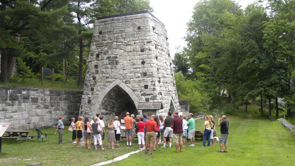
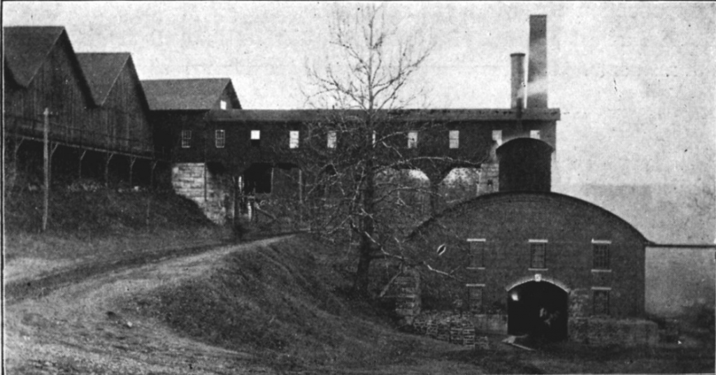
Learn about the historic iron industry of the Upper Housatonic Valley, by the Friends of Beckley Furnace. Built in 1847, the furnace produced high quality iron until 1918, and is one of the last surviving examples of the 19th and early 20th century blast furnaces that were once commonplace CT sights, and is listed on the National Register of Historic Places. There were 21 furnaces in northwestern CT, as rich veins of iron ore were discovered in the hills near the town of Salisbury. During the American Revolution, CT-forged iron helped fuel the manufacture of American weaponry, most notably the cannons used by the Continental Army, Union weapons for the Civil War, and railroad car wheels. Tour begins when you arrive. 1 hour long tours–0.4 mile
140 Lower Road, East Canaan, just off US Rtes 44 & 7. If coming from the East, North, or West, take Route 44 to East Canaan, CT. At the Congregational church, turn South onto Lower Road, passing alongside the Church building, and continue for approximately 1/2 mile, turning to the right and down the hill. The former furnace office and the furnace stack are visible on your left. If coming from the South, take Rte 7 to Canaan, CT. Pass a railroad yard on your left, and just before you cross a bridge across the the Blackberry River, turn right into Lower Road, heading East. The Furnace is about 3 miles east of the intersection of Lower Road and East Canaan. GPS 42.0110 N, -73.2925 W
7 – Gt. Barrington, MA 11 AM – 1 PM
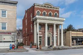
EXPLORE THE PERENNIAL PLANTS OF THE PFEIFFER ARBORETUM AT LONG POND
Join Devan Arnold, a Great Barrington Land Conservancy advisor and owner of Sassafras Land Care LLC, on a botanical journey through the woodlands of the Pfeiffer Arboretum to meet and learn some of our local floral wonders. 2 hours – 1 mile
The Pfeiffer Arboretum is at 249 Long Pond Road. From the center of Great Barrington, head north on Main St. and follow signs to Route 41. At the lights and bridge crossing the river, proceed onto Route 41, go under the overpass and then immediately make a left turn onto Christian Hill Road. Follow Christian Hill until reaching the blinking red light intersection with Division St. At the light, Christian Hill Road becomes Long Pond Road. Continue 0.6 mile from the light, on Long Pond Road. The Pfeiffer Arboretum sign and trailhead is on the left.
8 – Gt. Barrington, MA 2 PM – 4:30 PM
FOUNTAIN POND STATE PARK – THREEMILE HILL TRAIL HIKE
Fountain Pond State Park was the site of a turn-of-the-century Berkshire Street Railway trolley park. Join Alec Gillman, from the Mass. Dept. of Conservation & Recreation, to hear the story of this curious but short-lived place. Then take an easy to moderate hike along the Threemile Hill Trail, and further back in time, as we encounter evidence of industrial charcoaling, and unusual quartzite boulders scoured by glaciers. Build familiarity with and enjoy this accessible collection of conservation lands between DCR, Berkshire Natural Resources Council, Great Barrington Land Conservancy and Berkshire South Regional Community Center. The hike is mostly wooded trails, and a portion that follows sidewalks and a paved trail. Will be held rain or shine. 2.5 hours – 3.4 miles
Pre-registration is Required – phone 413-426-7890
Driving north on Route 7/Stockbridge Road, Great Barrington, the park is located 0.3 mile north of Rt 7 & Rt 183 intersection. OR driving south on Rt 7, the park is 1.3 miles south of Monument Mountain parking lot. Parking is available in dirt lot and highway pull-off. GPS 42.225222, -73.341306
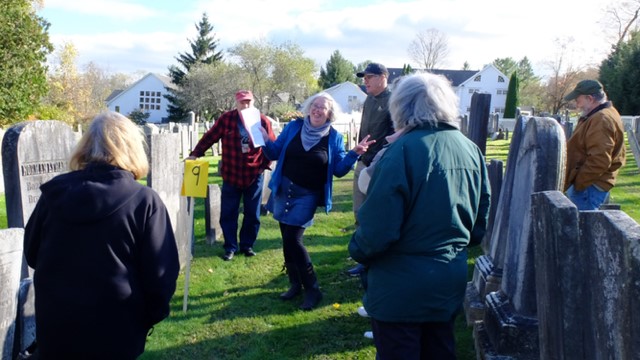
9 – Sharon, CT 2 PM – 4 PM
A BIOGRAPHICAL CEMETERY TOUR

The Sharon Burial Grounds are rife with the stories of the ill-fated, the less covered, and the almost forgotten. On this walk, the Sharon Historical Society, we will cover the histories of a few of the less-known members of the community and try to bring their stories to the surface. 2 hours – 1 mile
To register, email – curator@sharonhist.org
In Sharon, at the intersection of the clocktower and Veterans Memorial, head north on Main Street. Turn at Cemetery Road. We will meet at the Sharon Burial Grounds entrance. GPS 41.881654, -73.476641
SUNDAY – SEPT. 8
PLEASE NOTE–FOR ALL HIKES/OUTDOOR WALKS, PLEASE WEAR HIKING BOOTS/STURDY FOOTWEAR, SUGGEST BRINGING DRINK & SNACK, BUG REPELLENT AND BE PREPARED FOR INCLEMENT WEATHER
10 – Lee, MA 10 AM – 12 NOON
HISTORIC WALKING TOUR OF THE TOWN OF LEE, “GATEWAY TO THE BERKSHIRES”
Join Tracie Etheredge, from the Lee Historical Society, for a walking tour of Main Street, including learning about the important buildings, people and historical events that occurred in town. In the 19th century, Lee was a small but prominent paper making and marble quarrying industrial town. At its peak, the town had 25+ paper mills and several marble quarries, and the town’s prosperity was reflected in its downtown area along Main Street. The town’s first marble quarry opened in 1852 and Lee marble was initially used on a local level; but as demand for the stone in bigger markets grew, larger-scale commercial operations were established. Lee marble found its way into the fabric of major edifices throughout the Northeast and Mid-Atlantic states, including the House and Senate wings of the U.S. Capital, the Boston Public Library, St. Patrick’s Cathedral, Grant’s Tomb, and Philadelphia’s City Hall. The quarries played a significant role in the region’s economy until 1929, when the Great Depression brought the construction industry to a grinding halt, when orders for marble ceased overnight. Another economic backbone for Lee for 200+ years was it’s paper making industry. By the mid-1800’s, Lee, located on the Housatonic River, was the largest paper making town in the U.S. with 25+ paper mills. 2 hours – 1.5 miles
To register, email – ethere@gmail.com
Meet at the town picnic gazebo next to the post office on Frank Consolati Way. GPS 42.305441, -73.251334
11 – Pittsfield, MA 10 AM – 11:30 AM
GEOLOGY WALK AT HANCOCK SHAKER VILLAGE
Spend the morning exploring the rocks, stones, and landforms around historic Hancock Shaker Village and its Farm & Forest Trail, looking for evidence of glaciation, quarries, fossils, and other secrets of the earth. NOTE: This walk does not include general admission to the Village. Admission to the Village can be purchased after the free Heritage Walk. 1.5 hours – approx. 2 miles.
To register, 413-443-0188 x-213 or email – cdickinson@hancockshakervillage.org
Meet at the HSV Visitor Center-ticket desk, main entrance, on Rt 20 (34 Lebanon Mt. Road), Pittsfield/Hancock. From the junction of Rt 41 & Rt 20 junction- drive west on Rt 20 for 1/2 mile to the HSV entrance. GPS 42.43091, -73.34049
12 – Stockbridge, MA 10 AM – 12 PM and 1 PM – 3 PM
THE HISTORY OF INDIAN TOWN, STOCKBRIDGE
Indian Town was chartered in 1737 as a mission to the Mohican tribe to teach them English, about Christianity and about English agricultural practices. Recently, the Stockbridge-Munsee community in Wisconsin worked with Housatonic Heritage and other local partners to create a tour of the most important Mohican sites along the main street of Stockbridge. Trained by one of the creators of the walking tour, OLLI members will lead participants along Main Street to learn about the Mohicans, who lived in what is now Stockbridge for thousands of years, and aspects of their culture which are still present today. Stops include the Carriage Barn at the Mission House, the burial grounds and the site of the 2021 archeological dig for the Mohican meeting house. 1.5 hours–1.5 miles
To register by email – https://berkshireolli.org/event-5751634 or phone 413-236-2190 M-F 9 am – 4 pm
Park and meet in the Stockbridge town offices parking lot at 50 Main St.
For more information about the Stockbridge-Munsee Community, click here: https://www.nativeamericantrail.org/stockbridge-walking-tour/
13 – Falls Village, CT 1 PM – 2 PM
ANCESTORS TO DESCENDANTS – AN ADAMAH FARM WALK
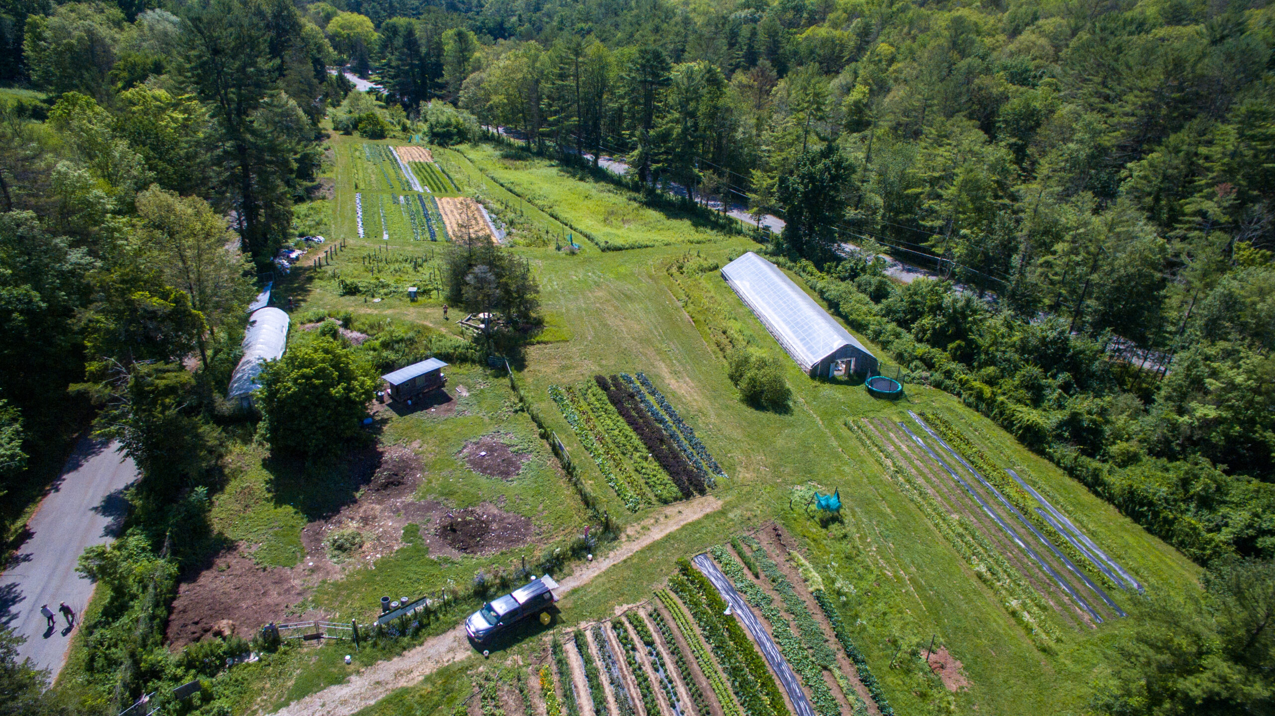
Join Janna Siller for this walking tour of Adamah Farm, where we grow produce using regenerative practices. As we wander through the perennial food forest, no-till fields, and compost and chicken yard, we’ll explore how Adamah Farm honors our ancestors with our descendants in mind. 1 hour, < 0.1 mile
To register,email – janna.siller@adamah.org
On Rt 7 or on Rt 126, about 2 miles south of the center of Falls Village, Adamah Farm is located on the corner of Beebe Hill and Johnson Rds. Park across the street from 181 Beebe Hill Rd. We’ll meet you there. GPS 41.940141, -73.347176
14 – Stockbridge, MA 1 PM – 2:30 PM
A PLEASANT STROLL OVER LAUREL HILL PARK AND THE MARY FLYNN TRAIL
Join Patricia Flinn for a leisurely history walk of the Laurel Hill Association’s signature property, and continuing on to the Mary Flynn Trail. The Association was founded in 1853, and is the oldest existing village improvement society in the U.S. NOTE: Laurel Park is not handicap accessible. However, the second part of the walk on the Mary Flynn Trail is accessible. (To join only the Mary Flynn Trail section of this walk, wait for the group at the end of Park St., which is two streets south of the Red Lion Inn, off of Rt 7. ) 1.5 hours–1.5 miles
Meet in the rear of the right side parking area behind the Stockbridge Town Offices building at 50 Main St. GPS 42.28164, -73.30583 GOOGLE MAP
SATURDAY – SEPT. 14, 2024
PLEASE NOTE–FOR ALL HIKES/OUTDOOR WALKS, PLEASE WEAR HIKING BOOTS/STURDY FOOTWEAR, SUGGEST BRINGING DRINK & SNACK, BUG REPELLENT AND BE PREPARED FOR INCLEMENT WEATHER
15 – Lenox, MA 8 AM – 10 AM
EDITH WHARTON’S WOODS, WETLANDS AND MEADOWS—LANDSCAPE HISTORY AND ECOLOGY

Join a Mass Audubon naturalist for a walk on the wild side at The Mount-Edith Wharton’s Estate. Explore the intersection of landscape history and ecology while enjoying the beautiful woods, meadows, wetlands. The walk will traverse nearly the full expanse of Edith Wharton’s original estate, including recently conserved land/trails leading to Edith Wharton Park on Laurel Lake. NOTE: Does not include an interior house tour, which can be arranged for a fee after the free Heritage Walk. 2 hours – 3 miles
Registration required via Mass Audubon’s online program registration system: https://www.massaudubon.org/programs/pleasant-valley/92827-wharton-s-woods-wetlands-and-meadows-landscape-history-and-ecology-at-the-mount . Please use the registration link only, do not respond by email.
From the traffic light junction of Rt 20 & Rt 7 in Lenox, head south on Rt 7, and drive 1 mile, and take a left turn onto Plunkett St. The Mount is right after making the turn. Meet in the main parking lot near the ticket booth. www.EdithWharton.org GPS 42.33558, -73.28293 GOOGLE MAP
16 – Gt. Barrington, MA 10 AM – 11: 30 AM
WILLIAM CULLEN BRYANT’S MAIN STREET, GREAT BARRINGTON
William Cullen Bryant (1794-1878) lived in Great Barrington in the years 1816-25. While living here he practiced law, married his bride, Fanny Fairchild of Alford, and wrote poetry. With Bernard Drew, from the Great Barrington Historical Society, participants on this walk will step back in time to the 1810’s, view locations where Bryant lived, married and worked. 1.5 hours – 5 blocks
Meet in front of the Town Hall on Main Street.
17 – Stockbridge, MA 10 AM – 12 NOON and 1 PM – 3 PM
THE HISTORY OF INDIAN TOWN, STOCKBRIDGE
Indian Town was chartered in 1737 as a mission to the Mohican tribe to teach them English, about Christianity and about English agricultural practices. Recently, the Stockbridge-Munsee community in Wisconsin worked with Housatonic Heritage and other local partners to create a tour of the most important Mohican sites along the main street of Stockbridge. Trained by one of the creators of the walking tour, OLLI members will lead participants along Main Street to learn about the Mohicans, who lived in what is now Stockbridge for thousands of years, and aspects of their culture which are still present today. Stops include the Carriage Barn at the Mission House, the burial grounds and the site of the 2021 archeological dig for the Mohican meeting house. 1.5 hours–1.5 miles
To register – https://berkshireolli.org/event-5751634 or phone 413-236-2190 M-F 9 am – 4 pm
Park and meet in the Stockbridge town offices parking lot at 50 Main St.
For more information about the Stockbridge-Munsee Community, click here: https://www.nativeamericantrail.org/stockbridge-walking-tour/
18 – Sharon, CT 10 AM – 12 NOON
VON AHN PRESERVE HIKE
Protected in 2022, the Von Ahn Preserve protects 170 acres of field and forest. Situated on the western side of Indian Mountain, this preserve is part of a contiguous corridor of forest that is home to a diversity of wildlife. Join Tim Hunter, from the Sharon Land Trust, for a moderate walk through fields and forests. Traverse the top of Indian Mountain and be in awe of the views overlooking Indian Lake and the Millerton Valley. 2 hours–2.5 miles
To register, email – timhunter@sharonlandtrust.org OR (860) 364-5137
Meet at the preserve parking area at 276 Millerton Road, Sharon, CT GPS 41.914940, -73.489645
19 – Gt. Barrington, MA 10:30 AM – 12:30 PM
GREAT BARRINGTON’S ARCHITECTURE & HISTORY – THE STORY OF GREAT BUILDINGS IN A GREAT TOWN
This walking tour with Nicholas Greene, from Clark, Green & Bek, will lead participants on a stroll through historic downtown Great Barrington as they discover the rich history of the town’s former and current inhabitants, their lives and the beautiful architecture they called home. 2 hours–1 mile
To register–greenen23@gmail.com (please indicate “GB Architecture Tour & Date” in the subject line)
Meet at the engraved stone monument near Great Barrington Town Hall, at the corner of Main and Castle Street GPS 42.19378, -73.36382 GOOGLE MAP
20 – Lanesborough/Pittsfield, MA 11 AM – 12:30 PM
HISTORIC HIKE TO BALANCE ROCK

Take a leisurely stroll over uneven terrain, with the Berkshire County Historical Society, to retrace the excursion Herman Melville took with Sarah Morewood and other friends in the summer of 1851 to Balance Rock in Balance Rock State Park within Pittsfield State Forest. Explore the history of the site and how it made its way into Melville’s prose. Finally, we will wander through the woods and along the streams that feed into the headwaters of the Housatonic River. 1.5 hours – 1 mile
Driving north on Rt 7 in Pittsfield, at the dam and road light at the south end of Pontoosuc Lake, (located just before reaching the Lanesborough town line), turn left on Hancock Road. Drive a few miles, to the intersection of Peck Rd. and Balance Rock Rd. Take a right on Balance Rock Road, and shortly, turn left off Balance Rock Road to the parking lot. GPS 42.508219, -73.264630
21 – Sheffield, MA 1:30 PM – 4:00 PM
WALK THE SHAYS REBELLION SECTION OF THE APPALACHIAN TRAIL
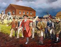
Learn about the Appalachian Trail, the most famous hiking trail in the U.S., and Shays’ Rebellion in 1787 (The Rebellion was a series of violent attacks on courthouses and other government properties in Massachusetts that began in 1786 and led to a full-blown military confrontation in 1787. The rebels were mostly ex-Revolutionary War soldiers-turned farmers who opposed state economic policies causing poverty and property foreclosures. The rebellion was named after Daniel Shays, a farmer and former soldier who fought at Bunker Hill and was one of several leaders of the insurrection.) that had some influence on the U.S. Constitution. Bess Dillman, from the Western Mass Chapter of the Appalachian Mountain Club, will lead us through fields, hardwood forests and across a boardwalk in a wetland. The trail is uneven with roots and rocks, but a lovely walk through a variety of habitats. 2.5 hours–3 miles
Registration is Required – limited to 20 participants – elizabeth.dillman@gmail.com or 413-528-7974
Appalachian Trail parking area is across the road from 1024 Sheffield/Egremont Rd., Sheffield. From Big Y in Great Barrington, drive 2.2 miles south on Rte 7 to a right on Lime Kiln Road. Drive one mile and turn right on Sheffield/Egremont Road. The monument is immediately on the right and parking area is on the left. GPS 42.1468, -73.3859 GOOGLE MAP
22 – Sharon, CT 2 PM – 4 PM
A BIOGRAPHICAL CEMETERY TOUR
The Sharon Burial Grounds are rife with the stories of the ill-fated, the less covered, and the almost forgotten. On this walk, the Sharon Historical Society, we will cover the histories of a few of the less-known members of the community and try to bring their stories to the surface. 2 hours – 1 mile
To register, email – curator@sharonhist.org
In Sharon, at the intersection of the clocktower and Veterans Memorial, head north on Main Street. Turn at Cemetery Road. We will meet at the Sharon Burial Grounds entrance. GPS 41.881654, -73.476641
22.A – Monterey, MA 2 PM – 4 PM
A WALK IN THE FOOTSTEPS OF THE PIONEERS THROUGH MONTEREY VILLAGE
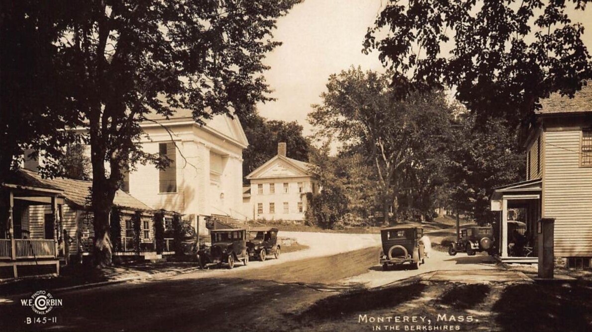
When you drive on Route 23 through the village of Monterey today, you’d never imagine how many people slogged their way through here from the mid 1600’s through the 1800’s: Rev. John Sargeant, the minister to the Stockbridge Indians, rode his horse “thro’ a most doleful wilderness” on his way to meet his native parishioners for the first time in 1734. Capt. John Brewer arrived in the fall of 1739 to build the sawmill and grist mill in what became the village; he “improved” the road to pass his mills and home site. Also, Col. Knox’s caravan of cannons were pulled on sleds by oxen from Ticonderoga to Boston in January of 1776. Join Rob Hoogs from the Bidwell House Museum and the Monterey Historical Society for a walk through time as we explore the road, buildings and remains of mills, houses, stores, meeting house, a fort, and the remains of the old sleigh road. We will start at the Monterey Town Hall (old Monterey Grange) and walk about one mile past these historic sites along the road, take a peek inside some of the buildings, and then walk through a field to the old Brewer home/fort site and through woods along the old sleigh road, and return. The walk could be rough and wet in some places. Wear walking/hiking shoes, and bring bug repellant. 2 hours – 2 miles
To register, email – bidwellhouse@gmail.com or http://bidwellhousemuseum.org/events
Meet at the Monterey Town Hall, 435 Main Rd. Parking is available behind Town Hall/Greene Park, along Main Road in the village, and uphill behind the Fire House (411 Main Road) at the intersection of Fox Hill Road.
SUNDAY – SEPT. 15, 2024
PLEASE NOTE–FOR ALL HIKES/OUTDOOR WALKS, PLEASE WEAR HIKING BOOTS/STURDY FOOTWEAR, SUGGEST BRINGING DRINK & SNACK, BUG REPELLENT AND BE PREPARED FOR INCLEMENT WEATHER
23 – Dalton, MA 10 AM – 11:30 AM
A WALK BACK IN TIME AT “THE BOULDERS” IN DALTON
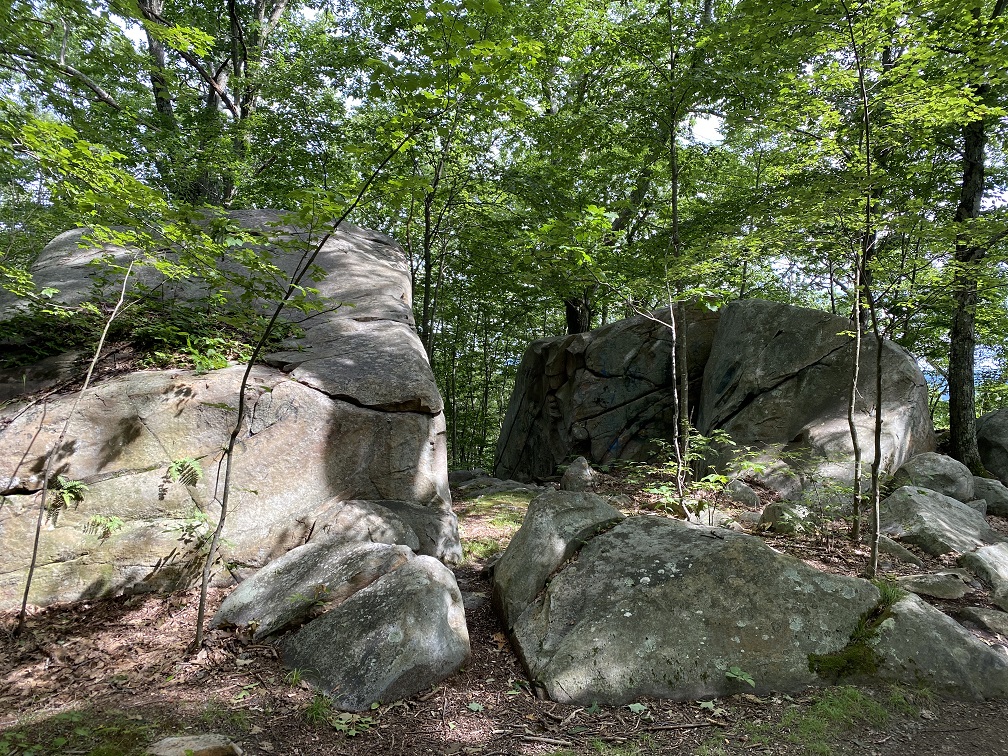
On this hike, with Charlotte Hood, from the Berkshire Natural Resources Council, we will discuss the rich natural and cultural history of the 685-acre Boulders property as we enjoy a relatively flat hike, making stops at significant sites along the way. 1.5 hours – 1.4 miles
To register, email – chood@bnrc.org
Gulf Road Trailhead (Northern Trailhead): Take routes 8/9 east from the center of Pittsfield. Take a left onto Park Avenue, passing Craneville School. Take a left onto Gulf Road. Park at the pull-off on the left, opposite the parking for the Appalachian Trail. GPS: 42.4816, -73.1783
24 – Lee, MA 10 AM – 1 PM
EXPLORE THE FAUNA, FLORA AND CULTURAL HISTORY OF BASIN POND RESERVE
This moderate hike with Aimee Gelinas, from Tamarack Hollow Nature and Cultural Center, will feature woods, wetlands, a beaver pond and boulders. Participants will learn about the flora (plants, trees, wild edibles), the fauna (signs of wildlife) and cultural history of this unique conservation area. Some stream crossings on step stones. Hike is free (donations accepted). This project has been supported in part by a grant from the Lee Cultural Council, a local agency which is supported by the Mass Cultural Council, a state agency. Co-sponsored by Berkshire Natural Resources Council. Visit www.tamarackhollow.org 3 hours – 2.5 miles
Registration is Required, email full_circle_o@yahoo.com
Driving on Route 20 in Lee heading east towards Becket, pass the Outlets Mall, and 4 miles later, turn left onto Becket Road. Parking will be on your left after 1/3 of a mile. GPS 42.2959, -73.1612
25 – Salisbury, CT 11 AM – 12 NOON
CANNON AT 20 PACES! THE RISE AND FALL OF THE AMES IRON WORKS
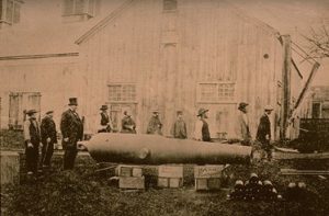
Contrast a shaded walk along a flat trail beside the Housatonic River with the smoky history of the same land. Lou Bucceri, from the Salisbury Association Historical Society, will share the history about the factory and the people that produced the most powerful cannon of the Civil War. Learn how the cannon destroyed no Confederate targets, but only the man and company who created it. 1 hour–0.25 mile
From the Rt 7 & Rt 112 junction in Falls Village–Drive west on Rt 112 to Dugway Road (opposite the Outfield Entrance to Lime Rock Park), turn right and follow Dugway Rd. for 2 miles. At iron bridge, turn left, then immediately turn right onto Housatonic River Rd. Drive 0.5 mile to parking lot for Falls Village Dam boat launch. OR from Rt 44 or Rt 41–Drive east on Rt 112 until you reach the Outfield Entrance to Lime Rock Park, then turn left onto Dugway Road and follow the above highlighted directions. GPS 41.96389, -73.37200 GOOGLE MAP
26 – Lanesborough/Adams, MA 1 PM – 3 PM
A CULTURAL AND NATURAL HISTORY TOUR OF MT. GREYLOCK’S SUMMIT: A MOUNTAINTOP WALK
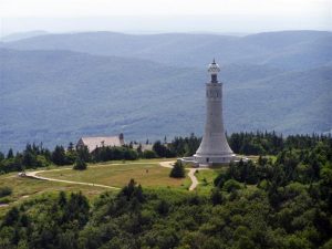
Join Mike Whalen, from the Mass. Dept. of Conservation & Recreation (DCR), and Peter Dudek, from Bascom Lodge, atop the most scenic, highest elevation (3,491′) and oldest wilderness state park in Massachusetts. Discover the 1930’s period of great park building when government work programs like the Civilian Conservation Corps (CCC), created special places for recreation. The rustic, yet elegant, “parkitecture” of Bascom Lodge became a distinctive style that defined America’s parks. This is an interpretive walk around the summit of Mount Greylock, with an emphasis on its unique ecology and historic structures as they comprise a fully realized historic landscape; and take an insider’s tour of Bascom Lodge. NOTE–summit parking fee may apply. Rain cancellation date will be Sept 22. 2 hours–0.1 mile
To register–413-499-4262 OR email michael.w.whalen@mass.gov
Meet at the summit of Mt. Greylock in front of Bascom Lodge. Access to the reservation is from Rockwell Rd., off Rt 7 in Lanesborough or from Notch Rd. in No. Adams. GPS 42.636875, -73.16692
27 – Falls Village, CT 1:30 PM – 2:30 PM
AMERICAN CHESTNUTS: LOST & FOUND
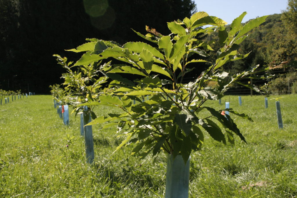

Join Woods Sinclair and friends for a talk and walk in a 2-acre planting American chestnut orchard. Learn of the dramatic sudden loss of this major tree and the ecological impact. Hear of The American Chestnut Foundation‘s efforts to restore this iconic tree to our landscapes. Rain cancels. 1 hour–<0.25 mile
To register–860-824-7454 or email fayaway7@gmail.com
From Falls Village, drive north on Route 7. At intersection of Rts 7 and 63, take Barnes Road to its end. Turn right on Under Mountain Road. The orchard is approximately 3 miles on the left–across from 392 Under Mountain Rd. GPS 41.94321, -73.28306 GOOGLE MAP
28 – Pittsfield, MA 3 PM – 5 PM
A WALK IN THE WOODS AT CANOE MEADOWS WILDLIFE PRESERVE
Join Deena Gilbert, from the Berkshire County Hiking Group, for a walk through Canoe Meadows Wildlife Sanctuary, owned by Mass Audubon, which brings wilderness to Berkshire County’s largest city. Flat trails wind through the sanctuary’s scenic woods, fields, and wetlands, and along the edge of the Housatonic River. Sixty acres of open fields provides critical breeding habitat for grassland birds. No dogs, please. 2 hours–3 miles
From Rte 7/20 in Lenox, 0.5 mile south of Guidos Market, take Holmes Road at traffic light (by Family Footwear), and proceed 2.7 miles to preserve/sanctuary entrance on the right. GPS 42.445030, -73.252800
29 – Lenox, MA 3 PM – 4:30 PM
EXPLORE THE IMPRESSIVE GARDENS & LANDSCAPE OF THE MOUNT – HOME OF EDITH WHARTON
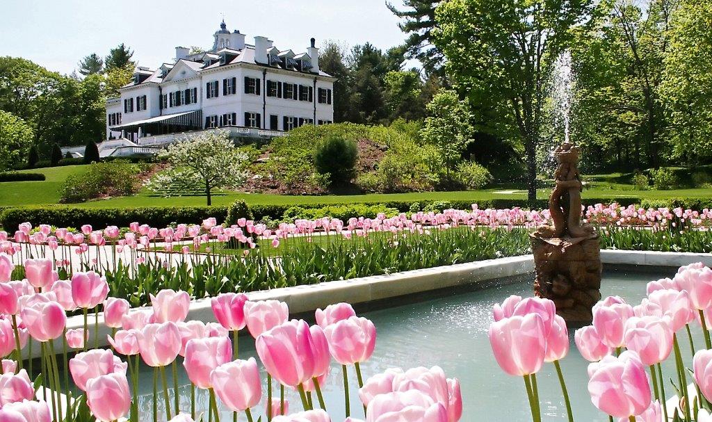
Anne Schuyler will guide you on an exploration of the impressive gardens and woodland trails of The Mount-Edith Wharton’s Estate, a 1902 home (a National Historic Landmark) of Pulitzer Prize-winning author Edith Wharton. NOTE: Does not include an interior house tour, which, for a fee, can be arranged before the free Heritage Walk. 1.5 hours — <1 mile
From the traffic light junction of Rt 20 & Rt 7 in Lenox, head south on Rt 7, and drive 1 mile, and take a left turn onto Plunkett St. The Mount is right after making the turn. Meet at the ticket booth. www.EdithWharton.org GPS 42.33558, -73.28293 GOOGLE MAP
30 – Lanesborough/Adams 5:30 PM – 6:45 PM
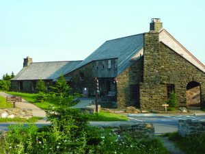
BOREAL FOREST ECOLOGY SLIDESHOW & SUMMIT WALK AT BASCOM LODGE & MT. GREYLOCK SUMMIT
Learn about the ecology and unique fauna and flora of high elevation Boreal Spruce-Fir forests on a short and easy plant/tree ID summit walk and a narrated slideshow in Bascom Lodge with naturalist Aimee Gelinas, director of the Tamarack Hollow Nature and Cultural Center. Program is free (donations accepted for Tamarack Hollow). This project has been supported by a grant from the William J. and Margery S. Barrett Fund, a fund of the Berkshire Taconic Community Foundation and supported in part by a grant from the Cultural Council of Northern Berkshire, a local agency which is supported by the Mass Cultural Council, a state agency.” 1.25 hours – minimal walking
Registration is Required, email – full_circle_o@yahoo.com
Meet at Bascom Lodge at the summit of Mount Greylock – the address is 3 Summit Road, Adams. The summit can be reached by taking Rockwell Rd from Lanesborough or Notch Road from North Adams. For more info visit: www.bascomlodge.net GPS 42.636875, -73.16692
SATURDAY – SEPT. 21, 2024
PLEASE NOTE–FOR ALL HIKES/OUTDOOR WALKS, PLEASE WEAR HIKING BOOTS/STURDY FOOTWEAR, SUGGEST BRINGING DRINK & SNACK, BUG REPELLENT AND BE PREPARED FOR INCLEMENT WEATHER
31 – Stockbridge, MA 10 AM – 12 NOON and 1 PM – 3 PM
THE HISTORY OF INDIAN TOWN, STOCKBRIDGE
Indian Town was chartered in 1737 as a mission to the Mohican tribe to teach them English, about Christianity and about English agricultural practices. Recently, the Stockbridge-Munsee community in Wisconsin worked with Housatonic Heritage and other local partners to create a tour of the most important Mohican sites along the main street of Stockbridge. Trained by one of the creators of the walking tour, OLLI members will lead participants along Main Street to learn about the Mohicans, who lived in what is now Stockbridge for thousands of years, and aspects of their culture which are still present today. Stops include the Carriage Barn at the Mission House, the burial grounds and the site of the 2021 archeological dig for the Mohican meeting house. 1.5 hours–1.5 miles
To register by email – https://berkshireolli.org/event-5751634 or phone 413-236-2190 M-F 9 am – 4 pm
Park and meet in the Stockbridge town offices parking lot at 50 Main St.
For more information about the Stockbridge-Munsee Community, click here: https://www.nativeamericantrail.org/stockbridge-walking-tour/
32 – West Stockbridge, MA 10 AM – 11:30 AM
NEIGHBORHOODS OF WEST STOCKBRIDGE – ALBANY STREET (ROUTE 41)
Join Bob Salerno, from the West Stockbridge Historical Society , to explore Albany Street (Route 41) – one of the main roads leading from West Stockbridge to Richmond. This former Indian trail became the key route to the west and north. The structures along the road reflect the town’s history, including commercial and industrial activity to immigration waves, and even an early constitutional challenge to slavery. Reception to follow at the Old Town Hall. 1.5 hours – 0.75 mile
To register, email- info@weststockbridgehistory.org
Park and meet behind St. Patrick’s Catholic Church on Route 41, north of the village center.
33 – Monterey, MA 9 AM – 11 AM
NATIVE TREE AND SHRUB IDENTIFICATION AND ECOLOGICAL FORESTRY CONCEPTS WITH A LOCAL STATE FORESTER
Explore the woodland trails of the Bidwell House Museum with forester Tom Ryan, from the Mass. Dept. of Conservation and Recreation. Participants are encouraged to ask questions and will learn about tree and shrub identification and ecological forestry concepts including: carbon sequestration, climate and wildlife habitat adaptive forestry. NOTE–Does not include a tour of the museum interior, which, for a fee, can be arranged after the free Heritage Walk. 2 hours–1.5 miles
To register, email – bidwellhouse@gmail.com OR go to the Museum website – Bidwell House Museum
From Monterey center–take Tyringham Rd. for 1.5 miles, and take a left onto Art School Rd. and drive 1 mile to the end; OR From the traffic light at Big Y in Lee–take Tyringham Rd and drive 5.5 miles, take a right onto Monterey Rd and drive for 2.3 miles, then take a right on Art School Rd. and drive 1 mile to the end at the Bidwell House Museum. GPS 42.20888, -73.21830 GOOGLE MAP
34 – Pittsfield, MA 10 AM – 1 PM
SHAKER MOUNTAIN HIKE
Hike the Shaker Trail, located across Rt 20 from Hancock Shaker Village, to the HSV North Family Site and to Mount Sinai, a spiritual “feast ground” for the Shaker community. Hancock Shaker Village staff will lead this hike, which will include stops at remains of mill sites, the North Family dwelling site (active from 1821-1867), and the summit of the mountain, where the Shakers held special celebratory services twice a year in the mid-19th century. Moderate to strenuous hike. NOTE: This walk does not include general admission to the Village. For a fee, admission to the Village can be arranged after the free Heritage Walk. 3 hours–2.5 miles.
To register–413-443-0188 x-213 or cdickinson@hancockshakervillage.org
Meet at the HSV Visitor Center/ticket desk, main entrance, on Rt 20 (34 Lebanon Mt. Road), Pittsfield/Hancock. From the junction of Rt 41 & Rt 20 junction- drive west on Rt 20 for 1/2 mile to the HSV entrance. GPS 42.43091, -73.34049 GOOGLE MAP
35 – Warren, CT 10 AM – 12 NOON
A WALK WITH THE WARREN HISTORICAL SOCIETY FOR A GUIDED TOUR OF THE OLD BURYING GROUND
 Heather Forstmann, Town Historian and Curator, will share the histories and secrets of a few of the cemetery’s residents. Light refreshments available afterwards, back at the Community Center.
Meet and start at the Warren Community Center at 7 Sackett Hill Rd., to the Old Burying Ground, next to 11 Cornwall Rd. Parking for those with mobility issues is limited. Please contact us if you have any special needs. 2 hours – < 0.5 mile
To register – www.WarrenCtHistoricalSociety.org/Events
36 – Pittsfield, MA 11 AM – 12 NOON
TOUR THE HISTORIC COLONIAL THEATRE

Enjoy a journey with Bill Munn and Libby Herland through the history of the gilded age Colonial Theatre, owned by the Berkshire Theatre Group. You will hear the story of the 1903 world-class theatre, movie house, National Historic Treasure appointment by Hillary Clinton, restoration, and 2006 grand re-opening. 1 hour
To register, email – meghan@berkshiretheatre.org
Located at 111 South St., just north of the junction of Rts 7 & 20 in the center of Pittsfield. Wear sensible walking shoes for walking through 3 floor levels. We do have elevator access. GPS 42.44622, -73.25402 GOOGLE MAP
37 – Gt. Barrington, MA 1 PM – 2 PM & 2 PM – 3PM
ENCOUNTERING W.E.B. DU BOIS–NATIONAL HISTORIC LANDMARK TOUR

W.E.B. Du Bois, the great African-American author and civil rights leader, was born and raised in Great Barrington and returned frequently. Join David Glassberg, UMASS History Professor, for an interpretive tour on a level woods trail leading to the foundation of Du Bois’s boyhood home–a National Historic Landmark and the first destination in the U.S. to tell the story of his life and legacy. 1 hour–0.5 mile
Meet at the Du Bois Homesite (at 612 So. Egremont Rd), located 2 miles south of Gt. Barrington center. At junction where Rt 7 & Rt 23 split off, take Rt 23 and drive west for about 1 mile. GPS 42.17702, -73.39430 GOOGLE MAP
38 – Pittsfield, MA 1 PM – 2:30 PM
PLAY BALL! FIRST INNING – BUT NOT NEAR MY WINDOWS
Join Larry Moore, director of Baseball in the Berkshires and Jim McGrath, manager of Pittsfield’s Natural Resource Program, as they start at “home” at the First Church of Christ on Park Square (23 East St.) where the famous Broken Window by-law was conceived. This tour will follow the “basepaths” around Pittsfield and its historic baseball lore. The walk will take our “players” by the Common – the site of many “All-Star” teams – the Old Elms, the Philadelphia and New York Bloomer Girls and the Brooklyn Royal Giants, then “stealing” up onto Maplewood Ave., where Amherst and Williams College “nines” made history. We will “wind-up” moving back down North St., enjoying some of the architecture of this historic city. 1.5 hours – 1.25 miles
To register, for one or both walks, email – baseballinberkshires@gmail.com
Park Square is located at the intersection of North & South Streets and East & West Streets. Meet at The First Church of Christ on the northeast side of Park Square, at 23 East St. Don’t worry about parking meters on Saturdays.
39 – Pittsfield, MA 3 PM – 4 PM
PLAY BALL! LAST INNING – A TOUR OF WAHCONAH BASEBALL PARK
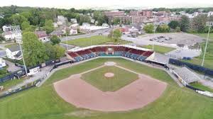
Join Larry Moore, director of Baseball in the Berkshires and Jim McGrath, manager of Pittsfield’s Natural Resource Program, for “peanuts, popcorn and Cracker Jacks”, will lead a tour of Wahconah Park. Prior First Inning participants are encouraged to meet at the Park, where a historic overview of the baseball park will be presented. 1 hour – minimal walking
To register, for one or both walks, email – baseballinberkshires@gmail.com
Driving north on North St. from Park Square/the center of Pittsfield, turn left at the Berkshire Medical Center, onto Wahconah Street and then to the park, about 0.25 mile on the left.
39.A – Pittsfield, MA 1 PM – 3 PM
REDISCOVERING THE LOST MILL VILLAGES OF WEST PITTSFIELD: STEARNSVILLE, BARKERVILLE AND THE TILLOTSON OSCEOLA MILL
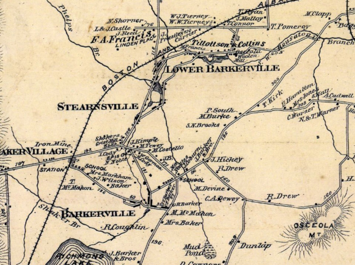
In the 19th century, virtually the entire economic and social life of West Pittsfield, Massachusetts was centered around the Stearns, Barker and Tillotson Mill Villages of the Southwest Branch of the Housatonic River. The villages provided employment for hundreds of men, women and children and had their own housing, stores, schools, and churches. However by 1890 most of the mills were closed and today are little known in the Pittsfield community.
Tour will begin with a slide presentation at the Berkshire Environmental Action Team (BEAT) Center; 20 Chapel St.; Pittsfield, MA and will be followed by a level 1.5 mile walk to the site of the former Barkerville Mill. Participants will also receive a copy of an illustrated history of the Mill Villages.
DIRECTIONS TO GET TO LOCATION — Berkshire Environmental Action Team (BEAT) Center; 20 Chapel St.; Pittsfield, MA. Take West Housatonic St. to left on Lebanon Avenue. One mile to left on Melbourne Rd. Then first right after bridge to Chapel St. BEAT building is first one on right.
To register: email gallagherfamily4@myfairpoint.net or call 603-562-5863.
SUNDAY – SEPT. 22, 2024
PLEASE NOTE–FOR ALL HIKES/OUTDOOR WALKS, PLEASE WEAR HIKING BOOTS/STURDY FOOTWEAR, SUGGEST BRINGING DRINK & SNACK, BUG REPELLENT AND BE PREPARED FOR INCLEMENT WEATHER
40 – Savoy/Windsor, MA 9:30 AM – 12 NOON
BOREAL SPRUCE-FIR FOREST & WATERFALL HIKE: PLANTS, TREES AND WILD EDIBLES AT THE TAMARACK HOLLOW NATURE & CULTURAL CENTER

Celebrate the first day of fall in the Boreal Forest! Led by naturalist and director of Tamarack Hollow Nature and Cultural Center, Aimee Gelinas, this hike will feature the unique high elevation flora of the boreal forest, watershed and a waterfall, including tips for tree, plant and wild edible identification. The hike is free (donations accepted for the Nature Center). This walk has been supported by a grant from the Berkshire Environmental Endowment Fund, a fund of the Berkshire Taconic Community Foundation. 2.5 hours – 2+ miles
Registration is Required, email full_circle_o@yahoo.com
Meet at Tamarack Hollow Nature & Cultural Center, 1515 & 1516 Savoy Hollow Rd, Windsor, MA. Directions can be found at www.tamarackhollow.org on the Donate & Directions page. *Please DO NOT USE a GPS to locate us on Savoy Hollow Road–Only enter Savoy Hollow Road via Griffin Hill Rd off Route 116 in Savoy, MA (you can use a GPS to find Griffin Hill Rd). From Rt 9, in Windsor center, take 8A north to Rt 116 in Savoy. At end of Rt 8A take a right onto Route 116, heading towards Savoy Center and Plainfield. Go approx 1.1 miles through the center of Savoy and take your first right after the center of town onto River Rd (there is a small light brown house with cream trim on the corner, this is #4 River Road). After the small house, cross the bridge over the river and go immediately to your right up the hill – this is Griffin Hill Rd (there is a sign saying “Tamarack Hollow-1 mile”). Continue up Griffin Hill Road (which will become Savoy Hollow Rd) for approx. 1 mile until you reach Tamarack Hollow. GOOGLE MAP
41 – Sheffield, MA 10 AM – 12:30 PM
12-15 MILE BICYCLE TOUR OF HISTORIC SHEFFIELD & ASHLEY FALLS

This bike tour will bring riders through the rural, scenic roads of Sheffield & Ashley Falls. Catherine Miller, from the Sheffield Historical Society, will stop to tell about historic sites along the way. Recommended for those who have experience biking long distances with some incline, though most of the route is flat. Bring your own bike and helmet. 2.5 hours – 12-15 mile ride
To register, email – cbmiller1941@gmail.com
Meet in the municipal parking lot behind the Mobil station, next to the Sheffield Historical Society grounds, 159 Main St./Route 7. GPS 42.110729, -73.353073
42 – Becket, MA 10 AM – 12 NOON
EXPLORING THE HISTORIC BECKET QUARRY AND FOREST

Join Ann and Ken Smith on this moderate hike to explore the Becket Quarry (and the beauty of this forest), now owned by The Trustees of Reservations. Learn about the history of the quarry with the Becket Land Trust and how TTOR are continuing the management and care of this unique and historic property. The granite quarry was used from the 1850s – 1950’s and is now filled with water, but you can still find glimpses of the old Quarry days with a standing wooden derrick, winches, and parts of old machinery once used by quarry workers. 2 hours–2 miles
From junction of Rts 20 & 102 in Lee, take Rt 20 east and drive about 14 miles, to the junction where Rt 8 turns left off Rt 20–here, you will turn right on Bonny Rigg Hill Rd. Drive about 2 miles and turn left on Quarry Rd. and drive for 1 mile, parking is on the right. GPS 42.25116, -73.02014 GOOGLE MAP
43 – Washington, CT 1 PM – 2 PM
PLANTING THE SEEDS FOR NEW UNDERSTANDING AT THE INSTITUTE FOR AMERICAN INDIAN STUDIES
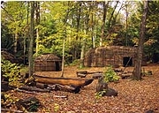
In many indigenous communities, plants are considered teachers because there is much that we can learn from them. Join the Institute for American Indian Studies staff for a guided walk along our museum trails and learn about scientific and Indigenous understandings of local plant life. End at our replicated 16th Century Algonkian Village for a discussion about traditional ecological knowledge and plant use. “NOTE–Does not include a tour of the museum interior. An inside tour, for a fee, can be arranged before or after the free Heritage Walk.” 1 hour – 1 mile
To Register, email – events@iaismuseum.org
Drive on Rt 67 North through Roxbury and turn right onto Rt 199. Follow Rt 199 North for 2 miles to Curtis Road on left and drive to the end. OR From North Western CT, take Rt 7 South to New Milford and Rt 67. Follow Rt 67 South to Roxbury and turn left onto Rt 199. Follow Rt 199 North for 2 miles to Curtis Road on left and drive to the end. OR From Torrington and Litchfield, Take Rt 202 West towards New Milford. Turn left onto Rt 47. Follow Rt 47 through Washington Depot. Turn right onto Rt 199. Follow for 1-2 miles to Curtis Road on right and drive to the end. Meet at the front of the museum, the last building on the right. GPS 41.61069, -73.32521 GOOGLE MAP
44 – Hinsdale, MA 2 PM – 4 PM
EXPLORE THE FAUNA, FLORA AND CULTURAL HISTORY OF THE OLD MILL TRAIL
This easy hike led by Aimee Gelinas, from the Tamarack Hollow Nature and Cultural Center, will follow the Housatonic River and will feature riverbank, forest and floodplain ecology. Participants will learn about the flora (plants, trees, wild edibles), the fauna (signs of wildlife) and cultural history of this unique conservation land along the Housatonic River. Hike is free (donations accepted). This project has been supported in part by a grant from the Hinsdale-Peru Cultural Council, a local agency which is supported by the Mass Cultural Council, a state agency. Co-sponsored by Berkshire Natural Resources Council. 2 hours – 1.5 miles
Registration is Required, email full_circle_o@yahoo.com`
From the center of Dalton, take Route 8 south to the Hinsdale line. From the town line, continue 0.4 mile to a left on Old Dalton Road in Hinsdale. The trailhead parking is the first, immediate left. https://www.bnrc.org/trails-and-maps/old-mill-trail/ GPS 42.4480, -73.1305
SATURDAY – SEPT. 28, 2024
PLEASE NOTE–FOR ALL HIKES/OUTDOOR WALKS, PLEASE WEAR HIKING BOOTS/STURDY FOOTWEAR, SUGGEST BRINGING DRINK & SNACK, BUG REPELLENT AND BE PREPARED FOR INCLEMENT WEATHER
45 – Washington, MA 10 AM – 12 NOON
THE SECRETS OF MUDDY POND & THE BUILDING OF THE 1ST U.S. RAILROAD MOUNTAIN CROSSING
Dave Pierce, from the Chester Railway Station Museum, offers this hike to Muddy Pond, on the watershed divide of the Berkshires. You will learn of it’s interesting history, as this area presented unique challenges to Whistler’s father as he engineered the world’s first mountain railroad up and over the Berkshire plateau. Hinsdale, MA, is the highest point between Boston and Chicago along the rail line. This area is wonderfully scenic, has abundant wildlife and has an amazing history. Learn why this 5-acre Housatonic River headwaters has earned the title of “most deceptive body of water in Mass.” and the challenges it posed to the first railroad builders over the Berkshires Plateau. This is a level walk on the traprock on the side of the railroad tracks. A tour of the Chester Railway Station Museum, designated a National Historic Landmark in 2021, can be arranged after the free Heritage Walk. Donations for the Railway Station Museum is welcome. Heavy rain will cancel. 2 hours–4 miles
To register, email dpiercedlp@aol.com or 413-961-9166
Meet at Summit Hill Rd., and Upper Valley Rd. in Washington. From the junction of Rt 102 & Rt 20 in Lee–Drive 7 miles east on Rt 20 to West Becket, to the junction where Rt 8 splits. Turn left onto Rt 20-east/Rt 8-north. Drive for 5 miles, and at the bottom of a long hill, take a left turn onto Rt 8-north. Drive 10 miles to the Washington Town Hall and take a right turn onto Summit Hill Rd. Shortly, you will reach a narrow bridge over the railroad tracks–park along here. OR FROM DALTON–follow Rt 8 south (approx. 9 miles) and turn left onto Summit Hill Rd. in Washington. Within a short distance, you will reach a narrow bridge over the railroad tracks-park along here. Please don’t park past the bridge on Summit Hill Rd. GPS 42.37490, -73.11129 GOOGLE MAP
46 – Norfolk, CT 10 AM – 11:30 AM
A WALK TO STONEY LONESOME
Join Norfolk’s town historian, Richard Byrne, for a walk to Stoney Lonesome — a Norfolk Land Trust site. We will hike to the other side of Route 44 and the old railroad tracks that used to run through West Norfolk. The railroad was built in Norfolk in 1871. It was not an easy task because of the steep grade and hilly terrain. The route from Norfolk to Canaan wound around Haystack and Bald Mountains, and then passed through a rocky gorge blasted from the hillside known as Stoney Lonesome. This was the site of a train wreck that occurred in March of 1882, and several years ago Richard found the pin which had been used to pull the train back onto the tracks from the embankment below. Find out more about the history of the railroad and the legendary train wreck on this hike. 1.5 hours – 1.5 miles Rain date will be 9/29/24 at 10 AM
Drive on Route 44 to 155 Ashpohtag Road, Norfolk CT. The trailhead is marked and parking is available. GPS 42.01115, -73.21794
47 – Monterey, MA 10 AM – 12 NOON
A RAMBLE IN THE BIDWELL WOODS
On this guided “ramble” through the woods surrounding the Bidwell House Museum, Richard Greene will lead visitors through a landscape rich with history, verdant forests and evidence of animals who make these woods home. He will share his deep knowledge of these woods and the local wildlife with participants and also answer questions along the way. This is your chance to take a hike and learn about the wonders of the Berkshire landscape! The terrain may be rocky in a few places. NOTE–Does not include a tour of the museum interior, which can be arranged after the free Heritage Walk. 2 hours – 2.5 miles
To Register – email bidwellhouse@gmail.com
From Monterey center–take Tyringham Rd. for 1.5 miles,and take a left onto Art School Rd. and drive 1 mile to the end; OR From the traffic light at Big Y in Lee–take Tyringham Rd and drive 5.5 miles, take a right onto Monterey Rd and drive for 2.3 miles, then take a right on Art School Rd. and drive 1 mile to the end at the Bidwell House Museum. GPS 42.20888, -73.21830 GOOGLE MAP
48 – Gt. Barrington, MA 10:30 AM – 12:30 PM
GREAT BARRINGTON’S ARCHITECTURE & HISTORY – THE STORY OF GREAT BUILDINGS IN A GREAT TOWN

This walking tour with Nicholas Greene, from Clark, Green & Bek, will lead participants on a stroll through historic downtown Great Barrington as they discover the rich history of the town’s former and current inhabitants, their lives and the beautiful architecture they called home. 2 hours–1 mile
To register–greenen23@gmail.com (please indicate “GB Architecture Tour & Date” in the subject line)
Meet at the engraved stone monument near Great Barrington Town Hall, at the corner of Main and Castle Street GPS 42.19378, -73.36382 GOOGLE MAP
49 – Richmond, MA 1:30 PM – 3:30 PM
TOUR THE NORTHEAST SCHOOLHOUSE AND PART OF THE NORTHEAST DISTRICT
Join Gloria Morse and Bill Edwards, from the Richmond Historical Commission, for an interior view of the historic one room Northeast Schoolhouse, 1791-1937. This is Richmond’s last remaining one room schoolhouse not converted into a home. See the classroom, and photo display of Richmond from the 1930’s. Outside, from the lawn, view part of the Northeast District, remains of the Branch Tavern, and the Cyprian Branch and Linius Hall store and funeral parlor. 2 hours–minimal walking
To register, email gloriamorse1@gmail.com
Meet at 981 Summit Road, which is at the corner of Summit Road and Swamp Road. Parking is in the school yard off Osceola Extension Road. From Richmond – Take Rt. 41 to Summit Road. From Pittsfield – Take Barker Road/Swamp Road., which is just past Bartlett’s Orchard. From West Stockbridge – Take Swamp Road north to Summit Road.
50 – Lee, MA 3 PM – 5 PM
HISTORIC WALKING TOUR OF THE TOWN OF LEE, “GATEWAY TO THE BERKSHIRES”

Join Tracie Etheredge, from the Lee Historical Society, for a walking tour of Main Street, including learning about the important buildings, people and historical events that occurred in town. In the 19th century, Lee was a small but prominent paper making and marble quarrying industrial town . At its peak, the town had 25+ paper mills and several marble quarries, and the town’s prosperity was reflected in its downtown area along Main Street. The town’s first marble quarry opened in 1852 and Lee marble was initially used on a local level; but as demand for the stone in bigger markets grew, larger-scale commercial operations were established. Lee marble found its way into the fabric of major edifices throughout the Northeast and Mid-Atlantic states, including the House and Senate wings of the U.S. Capital, the Boston Public Library, St. Patrick’s Cathedral, Grant’s Tomb, and Philadelphia’s City Hall. The quarries played a significant role in the region’s economy until 1929, when the Great Depression brought the construction industry to a grinding halt, when orders for marble ceased overnight. Another economic backbone for Lee for 200+ years was it’s paper making industry. By the mid-1800’s, Lee, located on the Housatonic River, was the largest paper making town in the U.S. with 25+ paper mills. 2 hours – 1.5 miles
Join Tracie Etheredge, from the Lee Historical Society, for a walking tour of Main Street, including learning about the important buildings, people and historical events that occurred in town. Back in the day, Lee was a big marble producing and paper making town. 2 hours–1.5 miles
To register, email – ethere@gmail.com
Meet at the town picnic gazebo next to the post office on Frank Consolati Way. GPS 42.305441, -73.251334
SUNDAY – SEPT. 29, 2024
PLEASE NOTE–FOR ALL HIKES/OUTDOOR WALKS, PLEASE WEAR HIKING BOOTS/STURDY FOOTWEAR, SUGGEST BRINGING DRINK & SNACK, BUG REPELLENT AND BE PREPARED FOR INCLEMENT WEATHER
51 – So. Egremont, MA 10 AM – 11 AM
TOUR OF APRIL HILL HISTORIC FARMSTEAD AND GREENAGERS HEADQUARTERS
Join director of Greenagers , Will Conklin for a tour of Historic April Hill Farm. The tour will include the historic house and barns as well as visits to various farm operations including a large vegetable garden, orchard, and more. 1 hour – 0.5 mile
To register, email – director@greenagers.org or 413-644-9090
Meet at 62 Undermountain Rd., (Rt 41) So. Egremont, MA. From the north: while driving on Rt 23 through the the center of So. Egremont, MA, at the junction of Rt 23 & 41, turn onto Rt 41 and drive 1 mile. From the south: from Salisbury, CT, drive 12 miles on Rt 41. GPS 42.15456, -73.42070
52 – Monterey, MA 10 AM – 2 PM
FALL COLORS ALONG BOB’S WAY – A BNRC PROPERTY
Bob’s Way is a trail maintained by the Berkshire Natural Resources Council. The property is named for N. Robert Thieriot, a long-time conservationist, having started the Sonoma Land Trust in California and the Monterey Preservation Land Trust here in Massachusetts. He has donated or preserved more than 4500 acres in the Berkshires. Our hike will be gentle climbs over two small ridges. The trail offers us many choices so we can pick and choose our route through hardwood forests and wetlands. It will offer us outstanding views of the Berkshires and opportunities to reflect on the lives of early residents of these hills. 3 hours – 2.5 miles
To register, email– science@condon.net
From the center of Monterey, follow Route 23 East for 2 miles and the parking lot and trailhead will be on right of the road. If you pass the beaver ponds of Otis, turn around, as you’ve gone too far.
53 – Lenox, MA 10:30 AM – 12 NOON
BEHIND THE SCENES TOUR OF TANGLEWOOD–BOSTON SYMPHONY ORCHESTRA’S SUMMER HOME
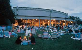
Enjoy a tour of the Boston Symphony Orchestra’s Tanglewood summer campus, the Koussevitzky Music Shed, Ozawa Hall, and the Linde Center for Music and Learning. Learn of the historic background of Tanglewood, the BSO and the Tanglewood Music Center. 1.5 hours– <1/2 mile
Starts at the Tanglewood Main Gate. From the Rt 102 & Rt 183 flashing light, intersection at the Berkshire Botanical Gardens, drive on Rt 183 north for 4 miles to the Main Gate. OR from Rt 41 in Richmond, across from the fire station, drive 4.5 miles east up Lenox Rd., and over then down Richmond Mt. Rd. Tanglewood is at the bottom of the mountain. Turn left and you will shortly see the Main Gate. OR from Lenox center, drive a couple of miles on West St./Rt 183 to the Main Gate. GPS 42.34924, -73.31084
54 – Salisbury, CT 11 AM – 12 NOON
CANNON AT 20 PACES! THE RISE AND FALL OF THE AMES IRON WORKS
Contrast a shaded walk along a flat trail beside the Housatonic River with the smoky history of the same land. Lou Bucceri, from the Salisbury Association Historical Society, will share the history about the factory and the people that produced the most powerful cannon of the Civil War. Learn how the cannon destroyed no Confederate targets, but only the man and company who created it. 1 hour–0.25 mile
From the Rt 7 & Rt 112 junction in Falls Village–Drive west on Rt 112 to Dugway Road (opposite the Outfield Entrance to Lime Rock Park), turn right and follow Dugway Rd. for 2 miles. At iron bridge, turn left, then immediately turn right onto Housatonic River Rd. Drive 0.5 mile to parking lot for Falls Village Dam boat launch. OR from Rt 44 or Rt 41–Drive east on Rt 112 until you reach the Outfield Entrance to Lime Rock Park, then turn left onto Dugway Road and follow the above highlighted directions. GPS 41.96389, -73.37200 GOOGLE MAP
Stockbridge, MA 1 PM – 3 PM
THE HISTORY OF INDIAN TOWN, STOCKBRIDGE
Indian Town was chartered in 1737 as a mission to the Mohican tribe to teach them English, about Christianity and about English agricultural practices. Recently, the Stockbridge-Munsee community in Wisconsin worked with Housatonic Heritage and other local partners to create a tour of the most important Mohican sites along the main street of Stockbridge. Trained by one of the creators of the walking tour, OLLI members will lead participants along Main Street to learn about the Mohicans, who lived in what is now Stockbridge for thousands of years, and aspects of their culture which are still present today. Stops include the Carriage Barn at the Mission House, the burial grounds and the site of the 2021 archeological dig for the Mohican meeting house. 1.5 hours–1.5 miles
To register by email – https://berkshireolli.org/event-5751634 or phone 413-236-2190 M-F 9 am – 4 pm
Park and meet in the Stockbridge town offices parking lot at 50 Main St.
For more information about the Stockbridge-Munsee Community, click here: https://www.nativeamericantrail.org/stockbridge-walking-tour/
55 – Chester, MA 1 PM – 4 PM
CHESTER AND BECKET RAILROAD, THE GRANITE LINE
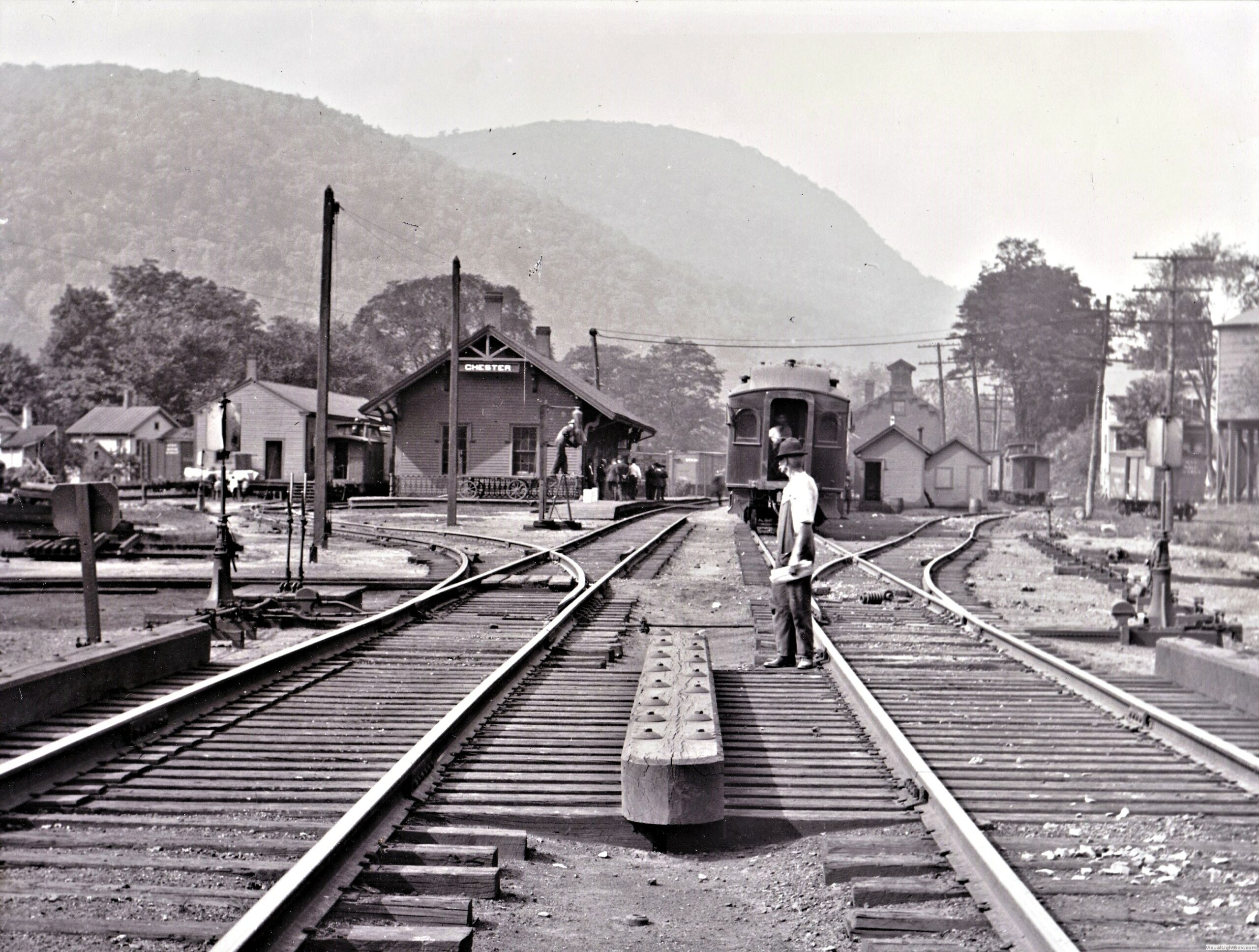
Take a hike with the Hilltown Hikers on a section of the Chester and Becket Railroad, built in 1896 as a 5.25-mile spur off the Boston & Albany Railroad to deliver granite from the Becket Quarries to the Chester finishing works. Both Chester and Becket issued bond stock in the quarry company to help in building this line because there was money to be made from the “Chester Blue Granite” for monuments and gravestones. This railroad was blasted out of the steep and winding side of the Walker Brook Valley. The first locomotive to run on this line was a wood burner, eventually upgraded to a coal burning locomotive. We will see the remains of a wooden trestle still standing on the trail and also learn how this route was used in Chester’s Emery Mines industry. The trail is relatively flat. Option to continue for another mile on the old railroad to view a mountain cistern built into the mountain. Donations for the newly conserved Chester Granite Company Finishing Works property are greatly appreciated. 3 hours – 2.5 miles
To register – westernmasshilltownhikers@aol.com or www.HilltownHikers.com
From junction of Rts 20 & 102 in Lee, take Rt. 20 east and drive 18 miles to the Chester/Becket town line, turn right on Hampden Street to the trailhead. GPS 42.279567, -72.988070
56 – Sheffield, MA 1:30 PM – 4:00 PM
WALK THE SHAYS REBELLION SECTION OF THE APPALACHIAN TRAIL
Learn about the Appalachian Trail, the most famous hiking trail in the U.S., and Shays’ Rebellion in 1787 (The Rebellion was a series of violent attacks on courthouses and other government properties in Massachusetts that began in 1786 and led to a full-blown military confrontation in 1787. The rebels were mostly ex-Revolutionary War soldiers-turned farmers who opposed state economic policies causing poverty and property foreclosures. The rebellion was named after Daniel Shays, a farmer and former soldier who fought at Bunker Hill and was one of several leaders of the insurrection.) that had some influence on the U.S. Constitution. Bess Dillman, from the Western Mass Chapter of the Appalachian Mountain Club, will lead us through fields, hardwood forests and across a boardwalk in a wetland. The trail is uneven with roots and rocks, but a lovely walk through a variety of habitats. 2.5 hours–3 miles
Registration is Required – limited to 20 participants – elizabeth.dillman@gmail.com or 413-528-7974
Appalachian Trail parking area is across the road from 1024 Sheffield/Egremont Rd., Sheffield. From Big Y in Great Barrington, drive 2.2 miles south on Rte 7 to a right on Lime Kiln Road. Drive one mile and turn right on Sheffield/Egremont Road. The monument is immediately on the right and parking area is on the left. GPS 42.1468, -73.3859 GOOGLE MAP
SATURDAY – OCTOBER 5, 2024
PLEASE NOTE–FOR ALL HIKES/OUTDOOR WALKS, PLEASE WEAR HIKING BOOTS/STURDY FOOTWEAR, SUGGEST BRINGING DRINK & SNACK, BUG REPELLENT AND BE PREPARED FOR INCLEMENT WEATHER
57 – Colebrook, CT 9 AM – 10:30 AM
THE US ARMY CORPS OF ENGINEERS AND THE CT FLOOD OF 1955
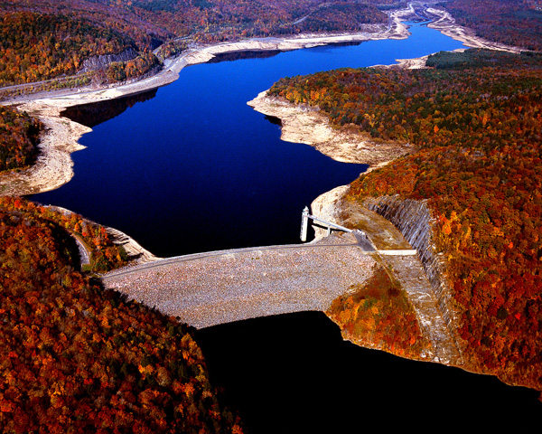
In August of 1955, the eastern U.S. was hit by successive hurricanes. An incredible 25 inches of rain fell in parts of CT, where streams and rivers were unprepared for the deluge. During this tour of the Colebrook River Lake dam, with James Jylkka, we will discuss the worst flood in CT history and the ongoing role of the US Army Corps of Engineers in flood risk management. Approx. 1.5 hours – 0.75 mile
To register – james.jylkka@usace.army.mil or phone # 860 379-8234
Driving northbound from Rt 44 in Winsted, take Rt 8 north. Approximately 4 miles north of the Shell station, look for the stone pillars on the right, and turn here. Driving southbound from Rt 57, take Rt 8 south. After crossing into CT, you will pass the boat launch. Proceed 1 mile south and look for the stone pillars on the left, and turn here. 41°59’53.2″N 73°02’49.2″W
58 – Stockbridge, MA 9:30 AM – 11:30 AM
TREE IDENTIFICATION WALK AT LOWER BOWKER’S WOODS
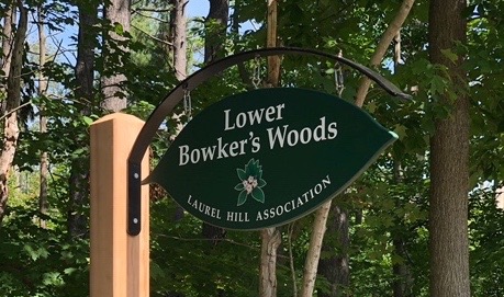
Chelsey Simmons, of Berkshire Environmental Action Team (BEAT) will lead this walk. Learn key characteristics of common trees in western Massachusetts and get tips to help identify them. The trail meanders along the Housatonic River and through a charming upland forest with old stone walls and excellent views of the River. Limited to 10 participants and minimal parking, with additional parking off the side of the road. 2 hours – 1 mile
To register, email – chelsey@thebeatnews.org
Heading west on Main Street, Stockbridge, continue through the center of town and past the Stockbridge Golf Course. After crossing the golf course bridge, bear right on Glendale Middle Rd., and continue for approximately half a mile. The trailhead will be on the right. A small green sign reads “Lower Bowker’s Woods”. GPS 42.282943, -73.337968
59 – Becket, MA 11 AM – 12 NOON
92 SEASONS OF JACOB’S PILLOW DANCE FESTIVAL
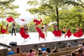
The buildings and grounds of Jacob’s Pillow have many stories to tell, including Indigenous roots, history as a stop on the Underground Railroad, and championing men dancers in the 1930s. Now recognized as a National Historic Landmark, the site maintains its rustic character while serving as a home for dance artists from throughout the world since 1933. This tour offers an opportunity to gain a behind-the-scenes understanding of why Time magazine called this secluded spot “the hub and mecca of dancing in North America.” 1 hour walk on gravel walkways and dirt paths; rain or shine
To register – https://my.jacobspillow.org/housatonic-heritage-walk/2358
Jacob’s Pillow is located at 358 George Carter Road, Becket, MA 01223. From Lee, follow Route 20 East for 9 miles into Becket, and then turn left onto George Carter Road. The main entrance to the parking lot will be on your right after ¾ of a mile. Meet at the Welcome Center, adjacent to the Ted Shawn Theatre. GPS 42.264087,-73.117888
60 – Falls Village, CT 1 PM – 2:30 PM
GUIDED WALKING TOUR OF HISTORIC FALLS VILLAGE
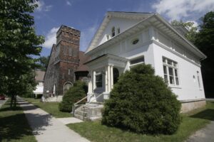
Join Judy Jacobs and Bill Beebe, from the Falls Village-Canaan Historical Society, for a guided tour of downtown Falls Village, a designated historic district. NOTE–Does not include a tour of the museum interior. An inside tour, can be arranged before or after the free Heritage Walk. 1 hour–0.5 mile
Meet at the Falls Village Depot at 44 Railroad Street, Falls Village. GPS 41.953487, -73.364268
61 – Gt. Barrington, MA 1 PM – 3 PM
EXPLORE THE PERENNIAL PLANTS OF THE PFEIFFER ARBORETUM AT LONG POND
Join Devan Arnold, a Great Barrington Land Conservancy advisor and owner of Sassafras Land Care LLC, on a botanical journey through the woodlands of the Pfeiffer Arboretum to meet and learn some of our local floral wonders. 2 hours – 1 mile
The Pfeiffer Arboretum is at 249 Long Pond Road. From the center of Great Barrington, head north on Main St. and follow signs to Route 41. At the lights and bridge crossing the river, proceed onto Route 41, go under the overpass and then immediately make a left turn onto Christian Hill Road. Follow Christian Hill until reaching the blinking red light intersection with Division St. At the light, Christian Hill Road becomes Long Pond Road. Continue 0.6 mile from the light, on Long Pond Road. The Pfeiffer Arboretum sign and trailhead is on the left.
62 – Sheffield, MA 10 AM – 12 NOON
SHEFFIELD AND THE CIVIL WAR: A CEMETERY TOUR

Learn all about Sheffield’s involvement in the Civil War by visiting the gravesites of its fallen soldiers. Our researchers will take you on a tour of some of Sheffield’s cemeteries and tell the stories of those who fought. 2 hours – minimal walking
To register, email – sheffieldhistoricalsociety@gmail.com
From points north and south, take Rt. 7 to Sheffield center. Park behind Gulottas and meet at the Historical Society building- the Dan Raymond House at 159 Main St. GPS 42.110729, -73.353073
63 – Gt. Barrington, MA 10:30 AM – 12:30 PM
GREAT BARRINGTON’S ARCHITECTURE & HISTORY – THE STORY OF GREAT BUILDINGS IN A GREAT TOWN
This walking tour with Nicholas Greene, from Clark & Green Architecture & Bek, will lead participants on a stroll through historic downtown Great Barrington as they discover the rich history of the town’s former and current inhabitants, their lives and the beautiful architecture they called home. 2 hours–1 mile
To register–greenen23@gmail.com (please indicate “GB Architecture Tour & Date” in the subject line)
Meet at the engraved stone monument near Great Barrington Town Hall, at the corner of Main and Castle Street GPS 42.19378, -73.36382 GOOGLE MAP
63.A – Pittsfield, MA 1 PM – 3 PM
REDISCOVERING THE LOST MILL VILLAGES OF WEST PITTSFIELD: STEARNSVILLE, BARKERVILLE AND THE TILLOTSON OSCEOLA MILL
In the 19th century, virtually the entire economic and social life of West Pittsfield, Massachusetts was centered around the Stearns, Barker and Tillotson Mill Villages of the Southwest Branch of the Housatonic River. The villages provided employment for hundreds of men, women and children and had their own housing, stores, schools, and churches. However by 1890 most of the mills were closed and today are little known in the Pittsfield community.
Tour will begin with a slide presentation at the Berkshire Environmental Action Team (BEAT) Center; 20 Chapel St.; Pittsfield, MA and will be followed by a level 1.5 mile walk to the site of the former Barkerville Mill. Participants will also receive a copy of an illustrated history of the Mill Villages.
DIRECTIONS TO GET TO LOCATION—Berkshire Environmental Action Team (BEAT) Center; 20 Chapel St.; Pittsfield, MA. Take West Housatonic St. to left on Lebanon Avenue. One mile to left on Melbourne Rd. Then first right after bridge to Chapel St. BEAT building is first one on right.
To register: email gallagherfamily4@myfairpoint.net or call 603-562-5863.
SUNDAY – OCTOBER 6, 2024
PLEASE NOTE–FOR ALL HIKES/OUTDOOR WALKS, PLEASE WEAR HIKING BOOTS/STURDY FOOTWEAR, SUGGEST BRINGING DRINK & SNACK, BUG REPELLENT AND BE PREPARED FOR INCLEMENT WEATHER
64 – Sheffield, MA 11 AM – 1 PM
TOUR MOON IN THE POND FARM

Get an inside look at an established permaculture farm that has been operating since 1991. Farmer Dom Palumbo will guide a leisurely walk and Q&A-talk of his 35 acre farm while discussing its history and place in the landscape and community of the southern Berkshires. This extraordinarily diverse farm, surrounded by conserved land by The Nature Conservancy, integrates organic and permaculture methods with environmentalism and food production on a small scale. It is an amazing and unique example of eco-agriculture in action. The Moon in the Pond Farm is also the home of Farm Education, Inc. (a 501c3) that teaches the technique and principles represented on the farm. Dom’s passion and interest in education and the wide variety of issues surrounding agriculture, the environment, food, nutrition, and food production lead the conversations in a myriad of directions and insure an animated and fun stroll! 2 hours – 0.25 mile
From Rt 7 in Sheffield center, turn onto Berkshire School Rd. In 0.25 mile, take a left onto Salisbury Rd; after 0.75 mile, turn left on Barnum St. and drive 1.3 miles. There is a “Moon In The Pond Farm” sign on the road at 816 Barnum, about 0.1 mi. south of the Nature Conservancy “Drury Trail” marker. Park on the right side of the road (not in the driveway). GPS 42.08139, -73.37835
65 – Stockbridge, MA 10:00 AM – 12 NOON
SCULPTING THE LAND: DANIEL CHESTER FRENCH’S ARTIST-DESIGNED LANDSCAPE AT CHESTERWOOD HISTORIC SITE
Join Historic Artists’ Homes and Studios, program of the National Trust for Historic Preservation, for this walk with Valerie Balint through the various designed landscapes of Chesterwood, including the house environs, formal gardens, and woodland walks. This was the summer home, studio, and gardens of America’s acclaimed sculptor of public monuments, Daniel Chester French, who created 100+ public sculptures. See the design features created by French while living here and place his efforts in the greater context of artist-designed landscapes throughout the country. Participants will go into the studio for a short introduction to this building and how both it and the house relate to the landscape. NOTE – this event does not include a formal tour of the studio or house interiors. An inside tour, for a fee, can be arranged for after the free Heritage Walk. 2 hours–2 miles
Space is limited, and pre-registration is required. email: vbalint@savingplaces.org
From Stockbridge center, drive west on Rt 102, turn left on Rt 183. 1/4 mile past the Norman Rockwell Museum, turn right onto Mohawk Lake Road, then left onto Willow St., which becomes Williamsville Rd., just before reaching Chesterwood. Meet at the Barn Gallery. GPS 42.33915, -73.28927
66 – Lenox, MA 10:30 AM – 12 NOON
BEHIND THE SCENES TOUR OF TANGLEWOOD–BOSTON SYMPHONY ORCHESTRA’S SUMMER HOME
Enjoy a tour of the Boston Symphony Orchestra’s Tanglewood summer campus, the Koussevitzky Music Shed, Ozawa Hall, and the Linde Center for Music and Learning. Learn of the historic background of Tanglewood, the BSO and the Tanglewood Music Center. 1.5 hours– <1/2 mile
Starts at the Tanglewood Main Gate. From the Rt 102 & Rt 183 flashing light, intersection at the Berkshire Botanical Gardens, drive on Rt 183 north for 4 miles to the Main Gate. OR from Rt 41 in Richmond, across from the fire station, drive 4.5 miles east up Lenox Rd., and over then down Richmond Mt. Rd. Tanglewood is at the bottom of the mountain. Turn left and you will shortly see the Main Gate. OR from Lenox center, drive a couple of miles on West St./Rt 183 to the Main Gate. GPS 42.34924, -73.31084
67 – Lee, MA 11 AM – 12:30 PM
A NATURE WALKING TOUR AT GOLDEN HILL TOWN FOREST
Join naturalist Linda Cysz, from the Lee Land Trust, for a meandering walk through this town forest with huge boulders and colorful fall mushrooms to get a sense of the natural setting and learn some of Lee’s town history. Golden Hill Town Forest’s 70-acre property was once owned by George Westinghouse as part of his estate known as Erskine Park. His house was in Lenox near Laurel Lake and his farmland extended across the road to the Golden Hill area. In 1939 George Westinghouse, Jr. donated this parcel to the Town of Lee. Here is where you’ll find the highest peaks in Lee at about 1220’ elevation. The Pinnacle has views to October Mt., Highlawn Farm and Laurel Lake. This is truly an enchanted geologic world. Easy loop trails guide you through the boulders, ledges, outcrops, wildflowers, mushrooms and old trees. In the early 1960’s this was a vibrant picnic spot with pavilion, stone fireplace and even electricity! Today, that area is an open field. 1 hour – 1 mile
Heading north on Rt 20 from the center of Lee, after crossing the railroad tracks and the river, drive for 0.8 mile to Golden Hill Road (across from the Retro Pop Shop). Turn right onto Golden Hill Road and drive uphill for 0.3 mile to a parking site on the right side of road, at Lee Town Forest sign. GPS 42.322441, -73.255433
68 – Stockbridge, MA 1 PM – 3 PM
THE HISTORY OF INDIAN TOWN, STOCKBRIDGE
Indian Town was chartered in 1737 as a mission to the Mohican tribe to teach them English, about Christianity and about English agricultural practices. Recently, the Stockbridge-Munsee community in Wisconsin worked with Housatonic Heritage and other local partners to create a tour of the most important Mohican sites along the main street of Stockbridge. Trained by one of the creators of the walking tour, OLLI members will lead participants along Main Street to learn about the Mohicans, who lived in what is now Stockbridge for thousands of years, and aspects of their culture which are still present today. Stops include the Carriage Barn at the Mission House, the burial grounds and the site of the 2021 archeological dig for the Mohican meeting house. 1.5 hours–1.5 miles
To register by email – https://berkshireolli.org/event-5751634 or phone 413-236-2190 M-F 9 am – 4 pm
Park and meet in the Stockbridge town offices parking lot at 50 Main St.
For more information about the Stockbridge-Munsee Community, click here: https://www.nativeamericantrail.org/stockbridge-walking-tour/
69 – Chester, MA 1 PM – 2:30 PM
THE CHESTER GRANITE AND POLISHING WORKS

The Hudson and Chester Granite Company was one of two granite finishing works in Chester for cutting and polishing the granite brought down to the Historic Factory Village on the Chester and Becket Railroad which was built for this purpose in 1896. “Chester Blue Granite” was brought down the steep mountain railroad from the Hudson and Chester quarry, known today as the Becket Quarry in Becket. The finishing works burned down after many prosperous years in business making monuments and gravestones and has been private property since, until now. In September of 2023 the Western Mass Hilltown Hikers purchased this lot, including a ten-foot shot saw and all the remains of its buildings and equipment. Tour the property on our newly created walking path and learn about the Granite Industry in Chester and Becket. Donations for the newly conserved Chester Granite and Polishing Works property are greatly appreciated. 1.5 hours – 1 mile
To register – westernmasshilltownhikers@aol.com or www.HilltownHikers.com
From junction of Rts 20 & 102 in Lee, take Rt. 20 east and drive 18 miles to the Chester center, turn left onto Main Street and bear right onto Prospect Street under the railroad and turn right to continue on Emery Street to the parking lot across from the ballfield. GPS 42.279570, -72.975155
END OF 2024 HOUSATONIC HERITAGE WALKS